Cyclone Crystal Approaches Mauritius
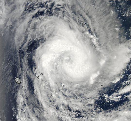
Cyclone Crystal Approaches Mauritius. Packing sustained winds of 80 miles (128 km) per hour. Also with gusts of up to 97 miles (157 km) per hour. Cyclone Crystal was approaching the island of Mauritius in the western Indian Ocean on December 26, 2002.
Mauritius is situated roughly 900 km (550 miles) due east of Madagascar. Also off Africas southeastern shore.This true-color image of Cyclone Crystal was captured by the Moderate Resolution Imaging Spectroradiometer. (MODIS) Therefore flying aboard NASA’s Aqua satellite.
Mauritius officially the Republic of Mauritius. (French: République de Maurice, Creole: Repiblik Moris)is an island nation in the Indian Ocean. The main Island of Mauritius is located about 2,000 kilometres. (1,200 mi) off the southeast coast of the African continent.
Although the Republic of Mauritius also includes the islands of Rodrigues, Agalega and St. Brandon. The capital and largest city Port Louis. Which is located on the main island of Mauritius. The city of Port Louis is commonly know for having cyclones and storms. Therefore this season of storms is high of lots of damage and weather related catastrophe. Also the NASA satellite captured amazing pictures and other images.
Credit: Image courtesy Jacques Descloitres, MODIS Land Rapid Response Team at NASA GSFC


