Eruption of Stromboli Volcano, Italy
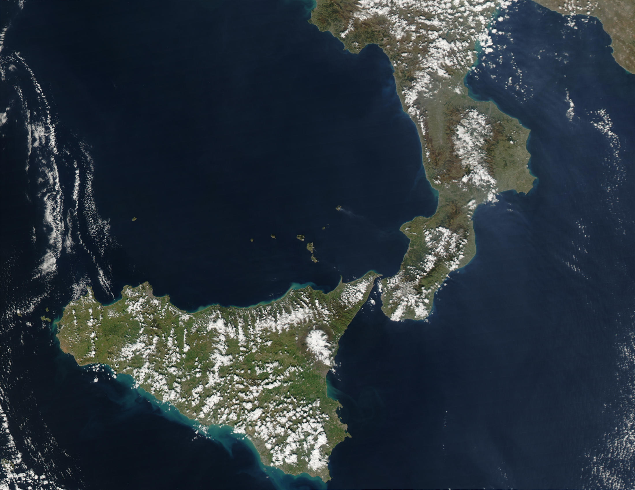

The northernmost of Italy’s Aeolian Islands, Stromboli is simply the summit of a volcanic mountain that rises up out of the sea. The volcano has been in a virtually constant state of eruption since Roman times, and its spectacular nighttime eruptions make it a popular volcano-watching location. In recent times, most eruptions result in lava and pyroclastic flows toward the northwest coast of the island. This image from the Moderate Resolution Imaging Spectroradiometer (MODIS) on the Aqua satellite on March 5, 2003, shows a plume of emissions from Stromboli wafting eastward over the Mediterranean Sea toward Italy. No thermal (heat) signature was detected by MODIS at this time.
Eruption of Stromboli Volcano, Italy stands 926 m (3,038 ft) above sea level, and over 2,700 m (8,860 ft) on average above the sea floor. There are three active craters at the peak. A significant geological feature of the volcano is the Sciara del Fuoco (“stream of fire”), a big horseshoe-shaped depression created in the last 13,000 years by several collapses on the northwestern side of the cone. Approximately 2 km (1.2 mi) to the northeast lies Strombolicchio, the volcanic plug remnant of the original volcano. Therefore the Eruption of Stromboli Volcano, Italy caused severe damage.
Credit: Image courtesy Jeff Schmaltz, MODIS Rapid Response Team, NASA GSFC


