Lava seen flowing on Volcán de Fuego in Guatemala
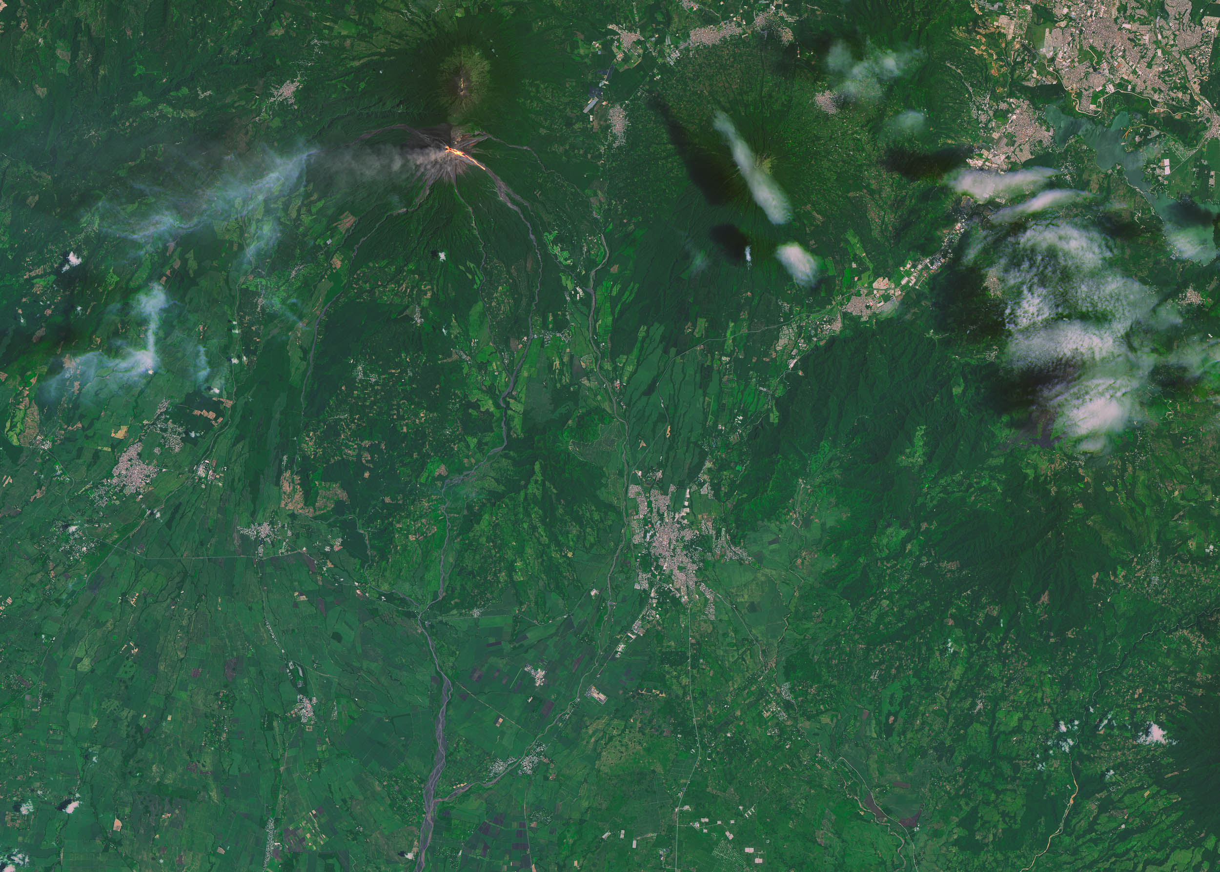

Lava seen flowing on Volcán de Fuego in Guatemala On September 7, 2016, the Operational Land Imager (OLI) on Landsat 8 captured this image of lava spilling down the slopes of Guatemala’s Volcán de Fuego, one of Central America’s most active volcanoes.
According to reporting from the Instituto Nacional de Sismologia, Vulcanologia, Meteorologia, e Hidrologia (INSIVUMEH), the latest bout of activity began on September 4, when lava rose as high as 200 meters (650 feet) above Fuego’s crater rim. Plumes of ash have reached heights of about 850 meters (2,800 feet). Lava seen flowing on Volcán de Fuego in Guatemala
The image is a composite of natural color (OLI bands 4-3-2) and shortwave Infrared (OLI band 7). Shortwave infrared light (SWIR) is invisible to the naked eye, but strong SWIR signals indicate increased temperatures. Guatemala , officially the Republic of Guatemala (Spanish: República de Guatemala), is a country in Central America bordered by Mexico to the north and west, Belize and the Caribbean to the northeast, Honduras to the east, El Salvador to the southeast and the Pacific Ocean to the south.With an estimated population of around 17.2 million, it is the most populous country in Central America and has the 11th largest national population in the Americas. Guatemala is a representative democracy; its capital and largest city is Nueva Guatemala de la Asunción, also known as Guatemala City
The volcano is located about 70 kilometers (40 miles) west of Guatemala City, Guatemala.
—


News coming your way
