The Porong River Delta
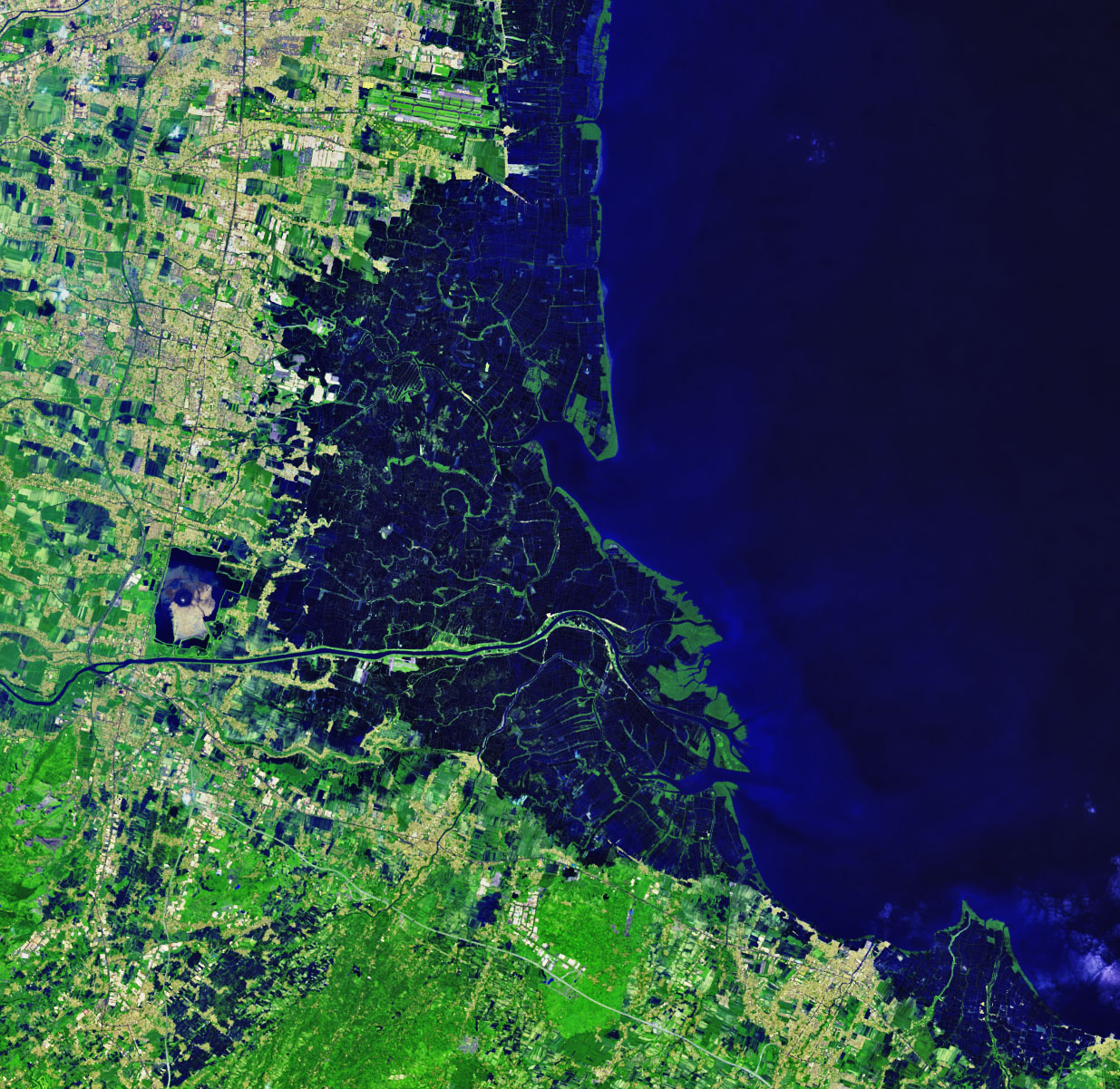

Today’s Image of the Day from NASA Earth Observatory shows visible changes in the Porong River Delta resulting from an active mud volcano.
Since 2006, boiling hot mud has been flowing across the island of Java, Indonesia, known as the Lusi mud flow.
Authorities have been diverting excess mud and water off the east coast of Java into the Porong River for more than a decade.
The increased load of sediment has expanded the river delta and created new space for mangrove forests.
This false-color Landsat satellite image shows the delta on May 10, 2019. The river flows in the eastern area of Java with predominantly tropical monsoon climate (designated as Am in the Köppen-Geiger climate classification). The annual average temperature in the area is 26 °C. The warmest month is October, when the average temperature is around 28 °C, and the coldest is February, at 22 °C. The average annual rainfall is 2473 mm. The wettest month is January, with an average of 426 mm rainfall, and the driest is August, with 20 mm rainfall. Also The Porong River Delta has many bright colors threwout
Porong River is a river flowing through Sidoarjo, East Java, Indonesia, about 700 km east of the capital Jakarta. It is one of the main branches of the Brantas River that discharges into Bali Sea, close to the Madura Strait, and is the main outlet for the Lusi mudflow.
—
By Chrissy Sexton, Earth.com Staff Writer
Image Credit: NASA Earth Observatory


